This week I went to an eye specialist. I’ve decided it was time to consider laser surgery as I’m short sighted and need glasses for driving and now I also need glasses to read (yes I know, a sign of aging!). I spent about an hour peering into various machines whilst my eyes were scanned, measured and flashed at. At one point I thought I was in a disco with strobe lighting, but unfortunately no John Travolta materialised.
Afterwards the specialist reviewed the enlarged computer images taken of my eyes; I asked him if the measurements were showing the contours of my eyes. He looked at me and said yes and was a little curious to know how I knew this, apparently not many people ask. I told him I was a property developer and it reminded me of the contour survey that we need before we start developing our sites (pardon the pun…get it sight / site?!).
So eyes and land, both need surveying before any work can be done. It makes sense really. The surgeon needs detail such as the height of my cornea and the builder needs to know the fall of the land.
This made me reflect on how important it is to understand the contours of land. I find that many of our clients do not understand what a contour survey is and why it’s necessary, so I thought I’d focus on this today.
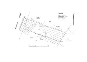
In the property world, a contour is an outline of a mass of land. A contour or detailed survey is done by a surveyor and required before you can start on the design of your buildings. Contour lines will be marked on the survey. Below are some tips* that can help explain the marking you’ll see:
- All points on a contour line are of the same elevation.
- No two contour lines can meet or cross each other except in the rare case of an overhanging vertical cliff or wall
- Closely spaced contour lines indicate steep slope
- Widely spaced contour lines indicate gentle slope
- Equally spaced contour lines indicate uniform slope
- Closed contour lines with higher elevation towards the centre indicate hills
- Closed contour lines with reducing levels towards the centre indicate pond or other depression.
- All contour lines must close either within the map boundary or outside.
*Reference: engineeringcivil.com and Mr Ramasesh Iyer
Once the architect or draftsperson has a contour survey then they can begin work on the plans and the survey will indicate how much site works may be required. For example, a sloping site will need to be levelled if you are using a slab construction and therefore the approximate height of retaining walls and volume of spoil to be removed need to be calculated. These costs need to be allowed for by the builder and he depends on the measurements on the contour survey for this data.
Accuracy of a survey is extremely important. On one site we found the surveyor (not mine, as this was a DA approved site purchased) had taken a measurement from one meter in from the rear boundary instead of right on the rear boundary. This was not picked up until after site preparations started and the site was cut. As the site sloped from rear to front, the retaining required on this rear boundary was much more than the builder had allowed for based on the plans. So it is important if you are buying DA approved sites, to have your own surveyor double check the plans and proposed levels which are based on the original contour survey.
I’ll keep you updated on whether I have my sight fixed but in the meantime, set your sights on the contour survey before you start developing property.
